


| Contact us |
| How to find us |
| Map of the MGL Website |
| POPI |
| Military supply policy |
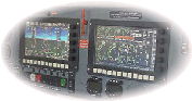
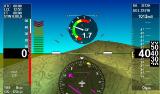
| iEFIS systems |
| iEFIS G4 |
| iEFIS Lite |
| iEFIS MX1 |
| iEFIS resources |
| iEFIS documents |
| iEFIS components |
| iEFIS Modules |
| V16 |
| V16 OEM |
| V16Technical |
| Using the V16 |
| Transponders |
| Garrecht Remote Mount |
| Sandia Transponders |
| Trig Avionics remote transponder |
| SP-12 ADS-B GPS |
| EFIS Accessories: Ferrites |
| Servo accessories |
| RDAC VD/VT |
| RDAC XF |
| RDAC XG |
| RDAC CAN (Rotax 912iS) |
| RDAC CAN (UL Power) |
| RDAC CAN MWB22 |
| SP-6 Compass |
| SP-7 AHRS |
| SP-9 AHRS |
| Legacy products: Accessories 1 |
| Legacy products: Accessories 2 |
| Legacy products: AHRS and compass |
| Southern Africa Navidata |
| Raster maps Southern Africa |
| Raster maps Eastern Africa |
| MGL Vector map and terrain data |
| Terrain data for G3 |
| Documents 1 |
| Documents 2 |
| MX1 Firmware Updates |
| iEFIS G4 Firmware |
| iEFIS G3 Firmware |
| iEFIS G2 Firmware |
| Odyssey/Voyager G2 Firmware |
| Odyssey/Voyager G1 updates |
| Enigma updates |
| CAN Devices Firmware |
| RF Devices Firmware |
| iEFIS G3 updates |
| G3 Beta |
| Updating G3 Firmware |
| iBOX V1 Firmware |
| iBOX V2 Firmware |
| iEFIS G3 - rebuilding internal disk |
| Odyssey/Voyager G2 updates |
| Update instructions for the Odyssey/Voyager G2 |
| Odyssey/Voyager G2 previous releases |
| Tools and applications |
| Development systems |